
Follow us on 


Feeding Stations & Toilets
 Feeding stations
- NSC
- Ballafreer
- Marown School
- Pippin Bank
- Cleaynagh Road (east)
- Cleaynagh Road (west)
- Oatlands Road (west)
- Oatlands Road (east)
- Ballakelly, Old Castletown Road
- Santon Church
- Mill House, Ballavar, Old castletown Road
- Orrisdale Road (east)
- Orrisdale Road (west)
- Rushen Abbey entrance, Ballasalla
- Malew Church
- Billown Farm
- Arbory School
- The Level, Colby
- Rushen Church
- Ballakilowey Picnic Area
- Ballakilpheric
- Sloc (bottom)
- Sloc (top)
- Round Table crossroads
- Eairy Cushlin (1)
- Eairy Cushlin (2)
- Dalby village
- Glen Maye
- Gordon
- Knockaloe Museum, Patrick
- Peel Town Hall
- Devil's Elbow
- Berk Farm, Glen Whyllin
- Bishopscourt
- Maughold
- Dhoon Halt
Toilets - (sanitary products will be available at portaloos only)
-
The start - National Sports Centre
- Ballafreer
- Marown School car park
- Glen Darragh Road
- Cleaynagh Road
- Oatlands Road
- Santon Church
- Orrisdale Road
- Ballasalla Commissioners
- Abbey Church Hall
- Malew Church
- Arbory Church
- Arbory School
- The Colby Glen Hotel
- Rushen Parking Field
- Rushen Church
- Ballakillowey Picnic Area
- Bottom of the Sloc
- Top of the Sloc
- Round Table crossroads
- Eairy Cushlin
- Dalby Village
- Gordon
- Glen Maye
- Peel Town Hall
- Devil's Elbow
- Kirk Michael
- Bishops Court
- Ballaugh
- Jurby Church
- near Smeale Farm (portaloo)
- Bride
- Andreas Village and Church
- Lezayre
- Ramsey Masonic Hall
- The Swan public house
- Ramsey Commissioners
- Maughold village
- Glen Mona public house car park
- Dhoon Glen
- Laxey village
- Onchan Church
- Port Jack
- The finish
Main Sponsors

Manx Telecom
Title Sponsor
Manx Timing Solutions
Event timing
3 Legs Ltd
Website
Innova Law
Legal Adviser
Ellan Vannin Events
Equipment
Up & Running
Prizes
Energy FM
Media Partner & Outside Broadcast
IFGL
Sustainability Partner
Civil Defence
Race Logistics
Colebourn
Equipment
ELS
Audio & lighting
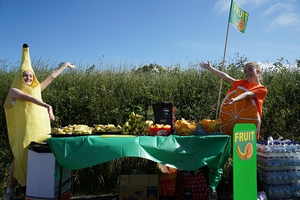
Feed Station Sponsors
-
Cruse Bereavement Support
National Sports Centre -

Claremont
NSC -
3FM
Mile 3 - Ballafreer, Ballahutchin Hill -

Barclays Bank (1)
Marown School -

IFGL
Mile 5 - Pippin Bank, Braaid Road -

Zedra
Cleayneagh Road (west) -

Simcocks
Cleayneagh Road (east) -
Hospice Isle of Man
Oatlands Road (west) -

Utmost Wealth
Oatlands Road (east) -

Trident Trust
Ballakelly (Old Castletown Road) -

Canada Life
Santon Church -
Manx Heart Foundation
Mile 11 - Mill House, Ballavar -

Suntera
Orrisdale Road - east -

Isle Stand up to Suicide
Orrisdale Road - west -

KPMG
Entrance to Rushen Abbey, Ballasalla -

Zurich
Malew Church -
Isle of Man Creameries
Billown Farm -

Canaccord Genuity
Arbory School -

PwC Isle of Man
The Level, Colby -
__________wi160he80moletterboxbgffffff.jpg)
Ramsey Crookall
Rushen Church -
Flutter International
Ballakillowey picnic area -

Capital International
Ballakilpheric -

Up and Running
Bottom of The Sloc -

FIM Capital
Top of The Sloc -

Rushen Round Table
Round Table crossroads -
__________wi160he80moletterboxbgffffff.png)
IQ EQ
Eairy Cushlin 1 -

Grant Thornton
Eairy Cushlin 2 -

Appleby
Dalby -
Barclays Bank (2)
Glen Maye -

Affinity
nr. Gordon House, Patrick -

Nedgroup
Patrick -
__________wi160he80moletterboxbgffffff.png)
Isle of Man Bank
Peel Town Hall -

Baker Tilly
Devil's Elbow -
Castletown Ale Drinkers (CADS)
Berk Farm (approaching Glen Wyllin, Kirk Michael) -
Hard Rock
Bishopscourt -

Maughold Parish Social Club
Maughold green -
Zen at the Glen
Dhoon Halt
Additional thanks to
-
Isle of Man Coastguard -
St John Ambulance -

MarksPics -

Visit Isle of Man -

Royal Manx Agricultural Society -
IoM Woodland Trust -

Samaritans